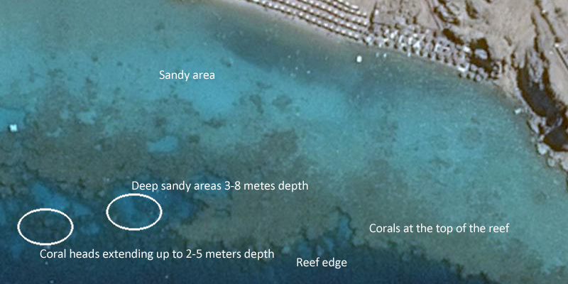
As mentioned in the book – go to e.g. Google Earth, zoom.earth or other service that provides satellite images of the earth. Based on the imagery you can actually get a pretty good indication of what it will look like when you enter the water.
I recommend that you look at some features and try to compare them with your own experience in an area. Here is an example from Sharm area.
I have made a longer blogpost on how to interpret the images to learn about the coral reefs, and how they look like on satellite images and underneath the water.

